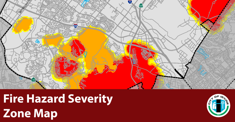
The California Office of the State Fire Marshal has released its 2025 Fire Hazard Severity Zone maps for the state of California, including Irvine. These maps use the latest climate data, fire history, topography, and wildfire modeling to classify areas as Moderate, High, or Very High fire hazard zones.
The City of Irvine is required by law to adopt the map within 120 days after it is released by the State. It is also required to make the map available to the public and collect community input before it is adopted.
The City cannot lower the hazard level designated by the State Fire Marshal, but it has the option to increase hazard levels or expand designated areas based on local conditions and knowledge.
Community feedback is encouraged to help ensure the map is as accurate and informed as possible. View the map and share your input through our public comment portal. All comments will be included in the public record. Learn more about the Fire Hazard Severity Zone Map.
Fire Hazard Severity Zone Maps
2025 Fire Hazard Severity Zone PDF Map
2025 Fire Hazard Severity Zone Interactive Map
2011 and 2025 Fire Hazard Severity Zone Interactive Comparison Map