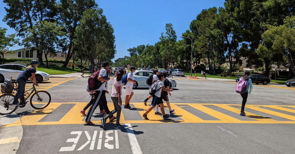
Irvine Mobility

bikers on pathways

Irvine Mobility Summit

The Irvine Mobility Summit was a free event hosted by the City of Irvine that took place June 4-6. The event brought together industry leaders, regional stakeholders, and staff with the goal of sharing, promoting, and developing a safer and more bikeable community for all ages and abilities. This program provided valuable insights and training for attendees and promoted collaboration to enhance mobility in Irvine and the broader Orange County region.

Learn more at cityofirvine.org/mobilitysummit.

Current Initiatives and Projects

Suggested Routes to Schools

Suggested Routes to School (SRTS) is a nationwide program that aims to create safer conditions around schools and encourages students, parents, and school staff to walk, bike, or roll to school. The City of Irvine, in partnership with Irvine Unified School District (IUSD), Tustin Unified School District (TUSD), and local public schools, is continuing the development of SRTS throughout Irvine. 

A total of 45 public schools, including a mix of elementary, middle, K-8, and high schools in the City of Irvine will receive their own tailored SRTS study. Each school will receive a School-Based Mobility Assessment, a Suggested Routes to School Map, and a Suggested Routes to School Action Plan. 

The City has conducted outreach efforts, including a survey and public workshop, to gather feedback in order to better understand the community’s transportation needs in and around all 45 public schools in Irvine. 

Project Schedule

  • Fall 2024/Spring 2025: Neighborhood school visits. The project team will conduct a Walk About. Look for opportunities to participate.
  • Spring 2025: Analyze the data and look at each school in detail. Look for information about a public workshop this spring to learn more.
  • Summer 2025: Draft Recommendations, Maps, and Suggested Routes to School Action Plan
  • Fall 2025: Final Recommendations and Suggested Routes to School Action Plans

Learn more at cityofirvine.org/department-administration/suggested-routes-school.

Irvine CONNECT

Irvine CONNECT provides free shuttle service for community members traveling between the northern end of Irvine to Irvine Station, with stops at parks, schools, hospitals, and shopping centers. Starting July 1, 2025, Irvine CONNECT will expand its route, reaching even more neighborhoods. 

Learn more at irvineconnect.org.

Protected Bikeway

A Class IV protected bikeway is a lane dedicated to bicyclists that is physically separated from drivers on the road. The separation may include, but is not limited to, grade separation, flexible posts, inflexible physical barriers, or on-street parking. Visit cityofirvine.org/protectedbikeway for more information. 

Irvine Shares the Way

Irvine Shares the Way is intended to improve the safety of everyone in Irvine, whether they are walking, bicycling, or driving. Irvine Shares the Way aims to raise awareness of traffic laws and remind our community how we can reduce the chances of a collision while walking, bicycling, and driving.

On a continual basis, the City of Irvine will provide new materials and features on our website and host workshops, family-friendly events, and more!

We are also always working to enhance our roadways, sidewalks, and bike trails to improve safety for all of our users. Stay informed of news and events by signing up for our email list at sharestheway@cityofirvine.org.  

Learn how you can Share the Way and Move with Care:

Sustainable Mobility Plan

The City of Irvine is continuing its commitment toward a safer, healthier, and greener Irvine by preparing a Sustainable Mobility Plan, an effort to both promote and improve the way people travel throughout the City.

The report was recommended for adoption by the Transportation Commission at the March 5 meeting and formally adopted by the City Council on March 26, 2024. View the Sustainable Mobility Plan

South Yale Corridor Improvements Project

The South Yale Corridor Improvements Project will evaluate the south segment of Yale Avenue in the City of Irvine (City), between the I-405 Freeway and University Drive. The project aims to better utilize the available roadway space to best serve community needs such as safety, access to neighborhoods and the school, as well as connections to nearby parks and trails. 

This project will work with the community to identify roadway concepts to address the needs of local users along South Yale Avenue. The project was identified in the City’s 2020 Strategic Active Transportation Plan and seeks to provide opportunities for multi-modal uses. The project development activities for this phase will entail the preparation of a Project Report (study), preliminary design plans, and environmental clearance. 

For more information, see the files below.  

You may share your feedback on the project by emailing Melissa Dugan, Supervising Transportation Analyst, at mdugan@cityofirvine.org.

More Information

Transit Vision Plan

Local Roadway Safety Plan 

Irvine Station First Last Mile Plan 2021

Strategic Active Transportation Plan

Bicycle Safety Tips and Information

Bicycle-Friendly Community

Irvine Pedestrian and Bicycle Bridge Prioritization Study

Irvine Station Bicycle Lockers

City Bicycle Safety Video

Protected Bikeway