Suggested Routes to School (SRTS) aims to create safer conditions around schools and encourages students, parents, and school staff to walk, bike, or roll to school. The City of Irvine, in partnership with Irvine Unified School District (IUSD), Tustin Unified School District (TUSD), and local public schools, has developed SRTS throughout Irvine.
A total of 45 public schools, including a mix of elementary, middle, K-8, and high schools in the City of Irvine, received their own tailored SRTS study with a School-Based Mobility Assessment, a Suggested Routes to School Map, and a Suggested Routes to School Action Plan.
Check Out SRTS Maps Down Below
The City has conducted outreach efforts, including collaboration with school leadership, public surveys, and two public workshops to gather feedback and better understand transportation needs in and around all 45 public schools in Irvine.
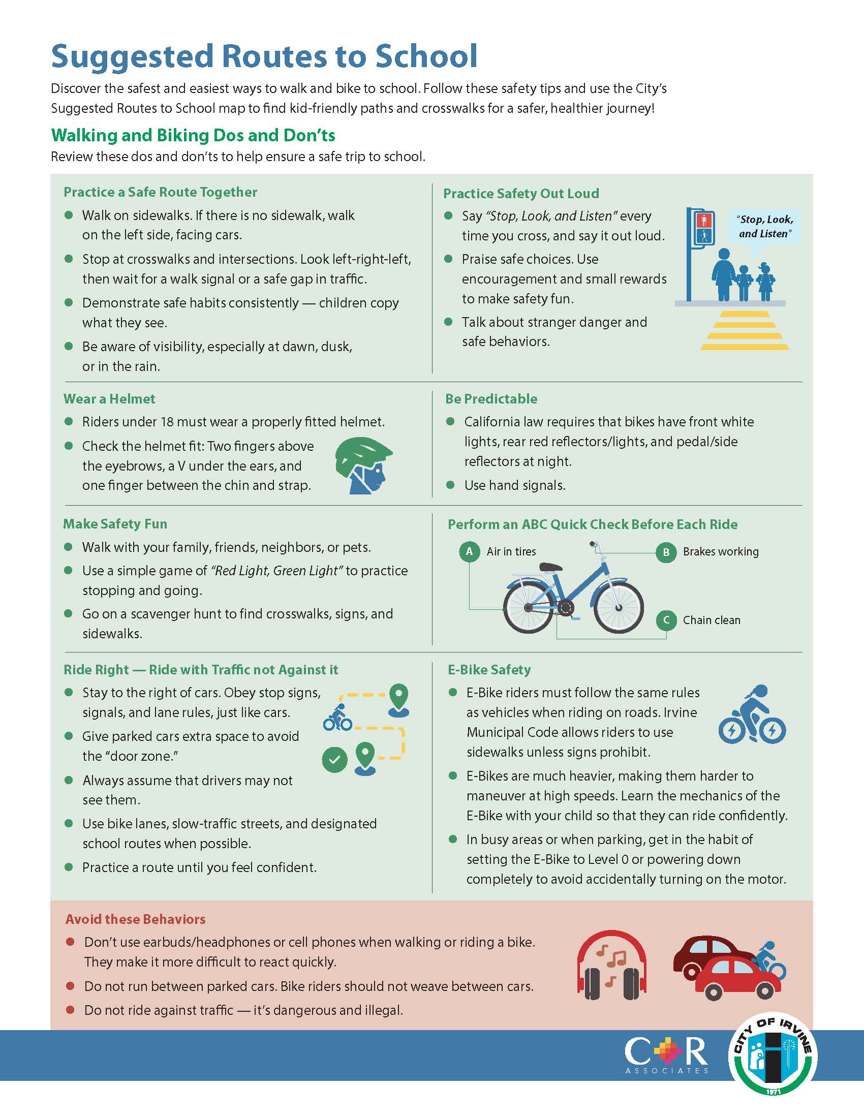
View Walking and Biking Tips